
- Image ID
- 42940
- Filename
- 3015547_0bead254.jpg
- Title
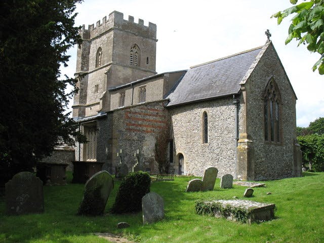
- St Andrew's church, Ogbourne St Andrew
- Location
- Church of St Andrew, Ogbourne St. Andrew, England, UK
- Caption
- The River Og flows south for about 8 kilometres (5 miles) from just south of Swindon until it meets the River Kennet in Marlborough. There were several settlements along this route, and two churches: St George and St Andrew. It is not surprising that the villages surrounding those churches were named after them; in this case, Ogbourne St Andrew. This church dates originally from the late 12th century with additions from the 13th and 14th centuries. It was restored by William Butterfield in 1847-49. It is Grade I listed by English Heritage: see Link
- Dates
- added July 22, 2013 | updated March 2, 2025
- Credit
- David Purchase
- Copyright
- Creative Commons BY-SA. Some rights reserved.
- EXIF Data
- 0.00000 sec
- Image Size
- 640 x 480 px (0 MP)
- Quality
- 6